Valkaniotis Sotiris, PhD
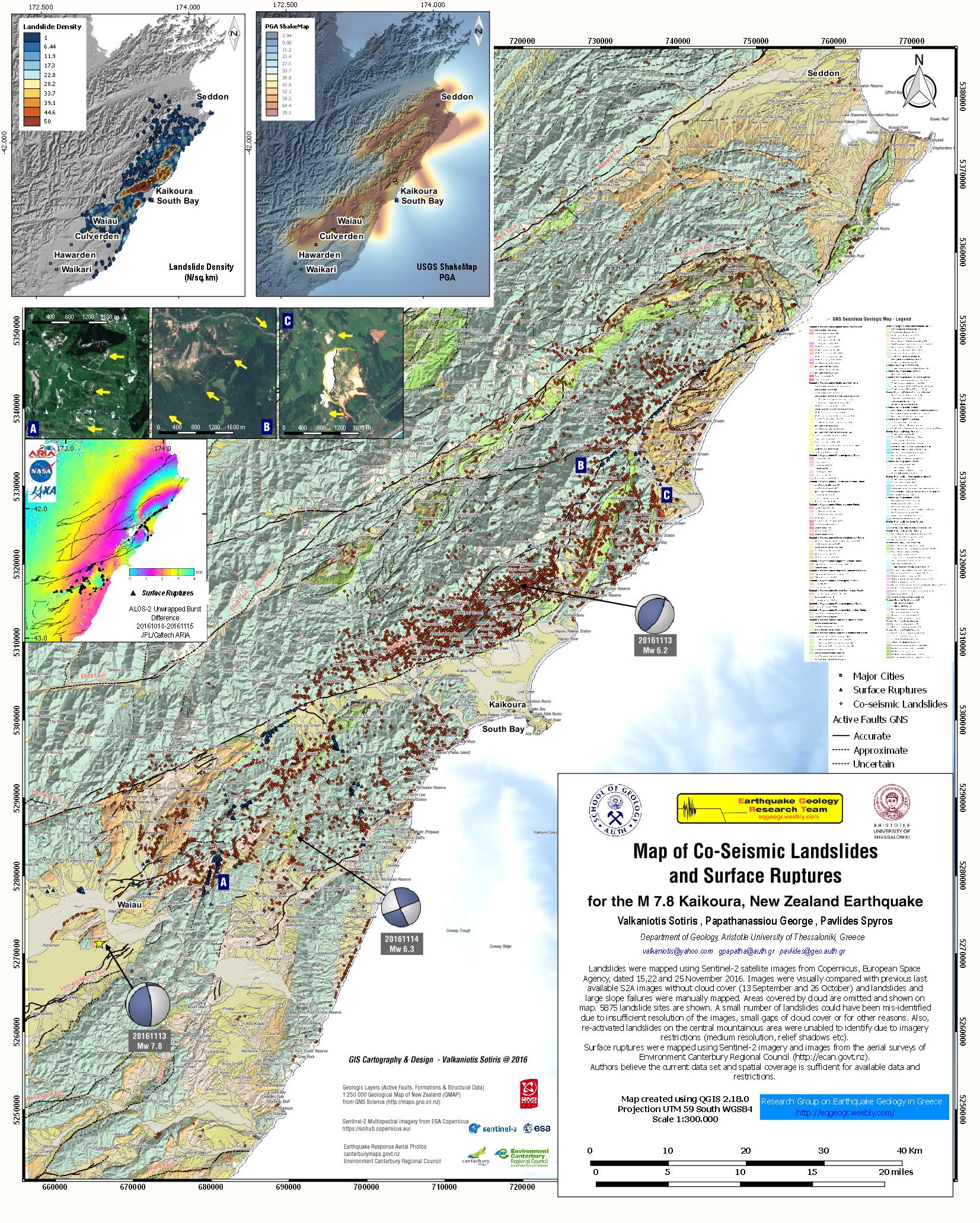
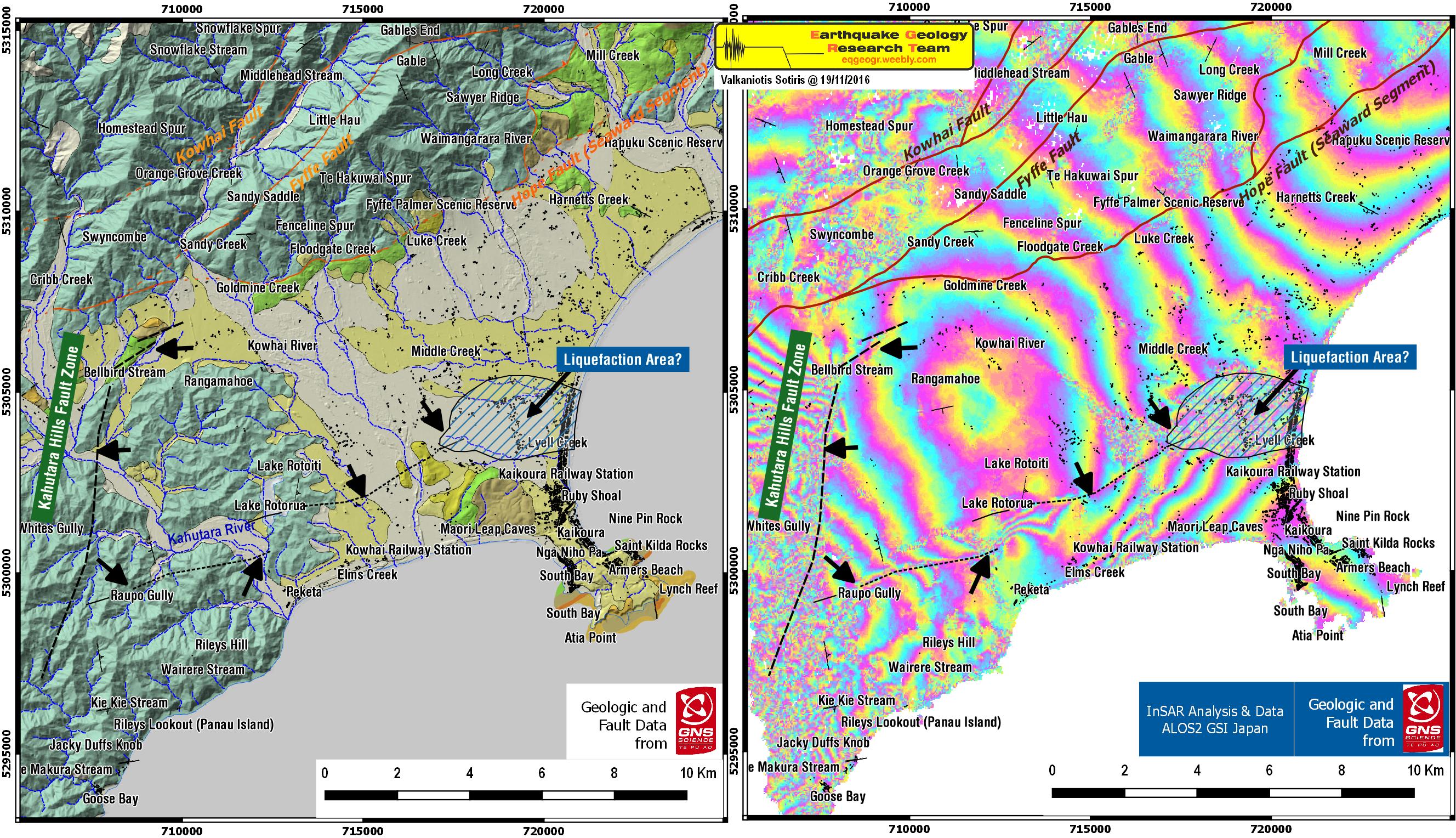
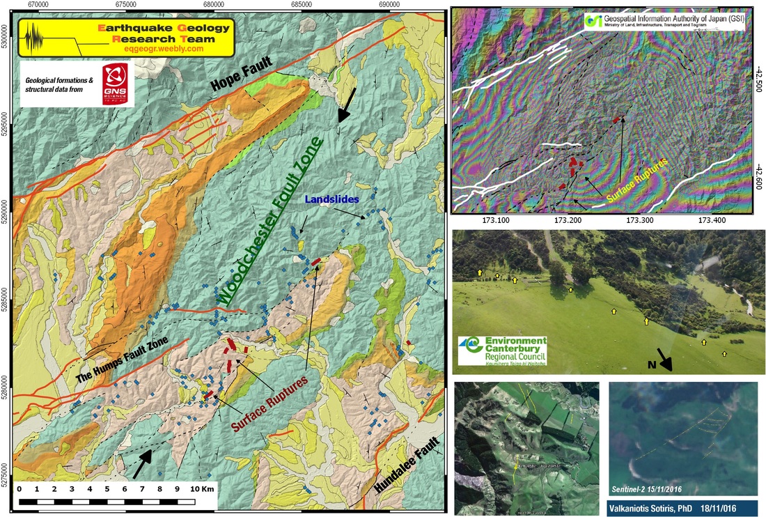
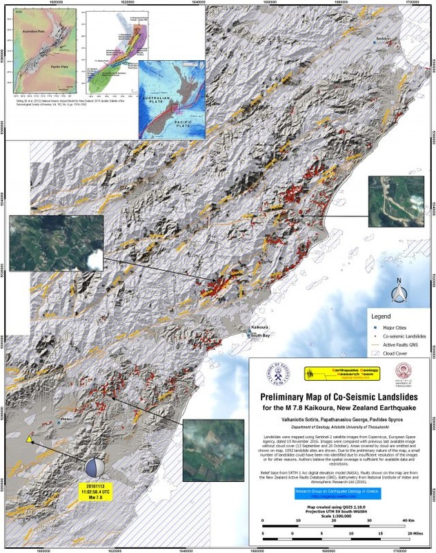
With the release of new Sentinel-2 images, and other available resources for the M7.8 Kaikoura earthquake, we present an update of the Map of Co-Seismic Landslides and Surfaces Ruptures. The first version (18/11/2016) is available here Preliminary Map Version 1
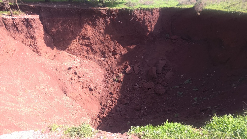
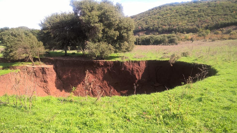
Landslides were mapped using Sentinel-2 satellite images from Copernicus, European Space Agency, dated 15,22 and 25 November 2016. Images were visually compared with previous last available S2A images without cloud cover (13 September and 26 October) and landslides and large slope failures were manually mapped. Areas covered by cloud are omitted and shown on map. 5875 landslide sites are shown. A small number of landslides could have been mis-identified due to insufficient resolution of the images, small gaps of cloud cover or for other reasons. Also, re-activated landslides on the central mountainous area were unabled to identify due to imagery restrictions (medium resolution, relief shadows etc).
Some local gaps in Sentinel imagery still exist due to cloud cover, but we believe the current map is very close to the major distribution of mass movement effects.
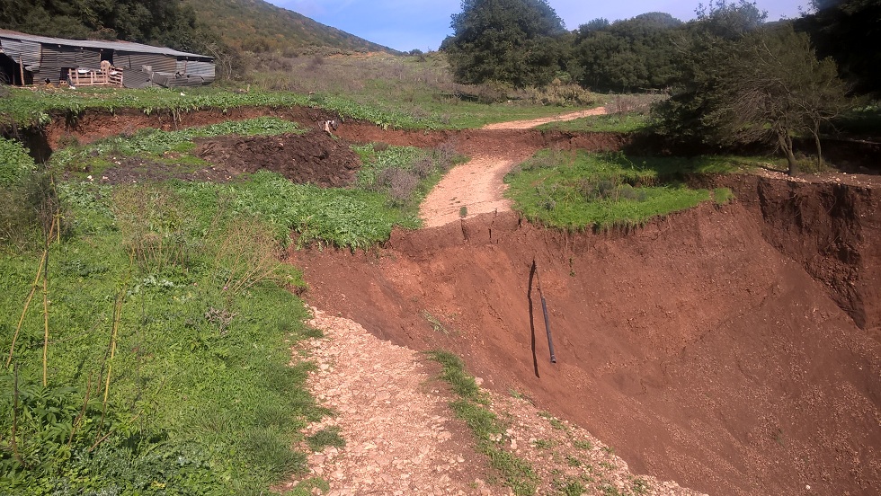
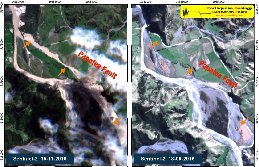
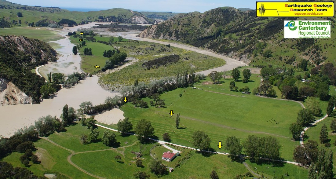
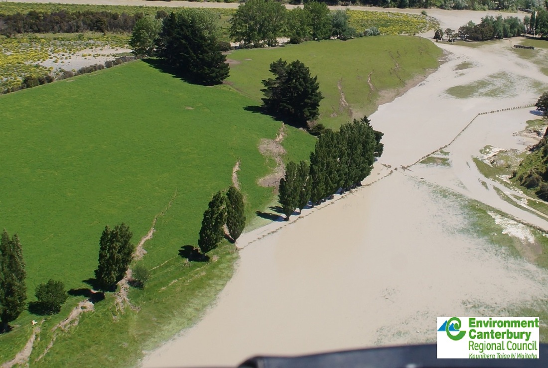
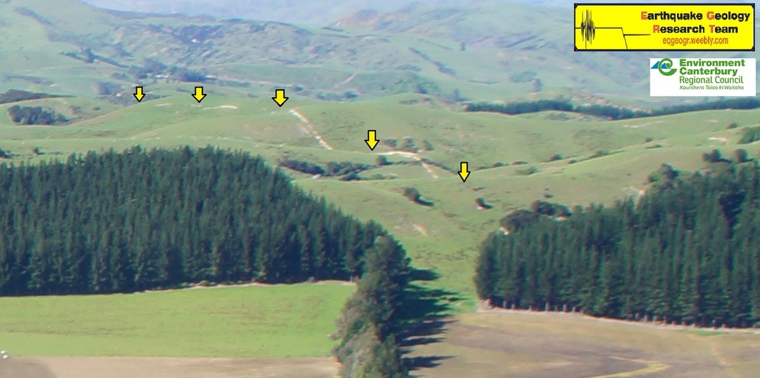
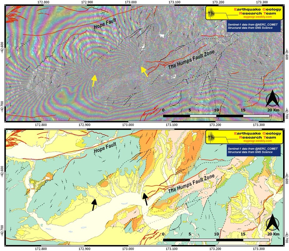
Surface ruptures were mapped using Sentinel-2 imagery and images from the aerial surveys of Environment Canterbury Regional Council (http://ecan.govt.nz).
High-resolution map files:
MAP - Version 2 5.5MB JPG
MAP - Version 2 10MB PDF
With the release of new Sentinel-2 images, and other available resources for the M7.8 Kaikoura earthquake, we present an update of the Map of Co-Seismic Landslides and Surfaces Ruptures. The first version (18/11/2016) is available here Preliminary Map Version 1
Landslides were mapped using Sentinel-2 satellite images from Copernicus, European Space Agency, dated 15,22 and 25 November 2016. Images were visually compared with previous last available S2A images without cloud cover (13 September and 26 October) and landslides and large slope failures were manually mapped. Areas covered by cloud are omitted and shown on map. 5875 landslide sites are shown. A small number of landslides could have been mis-identified due to insufficient resolution of the images, small gaps of cloud cover or for other reasons. Also, re-activated landslides on the central mountainous area were unabled to identify due to imagery restrictions (medium resolution, relief shadows etc).
Some local gaps in Sentinel imagery still exist due to cloud cover, but we believe the current map is very close to the major distribution of mass movement effects.
Surface ruptures were mapped using Sentinel-2 imagery and images from the aerial surveys of Environment Canterbury Regional Council (http://ecan.govt.nz).
High-resolution map files:
MAP - Version 2 5.5MB JPG
MAP - Version 2 10MB PDF
 RSS Feed
