Valkaniotis Sotiris,PhD
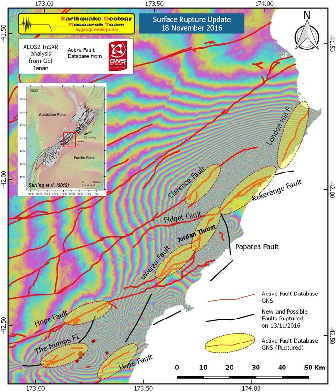
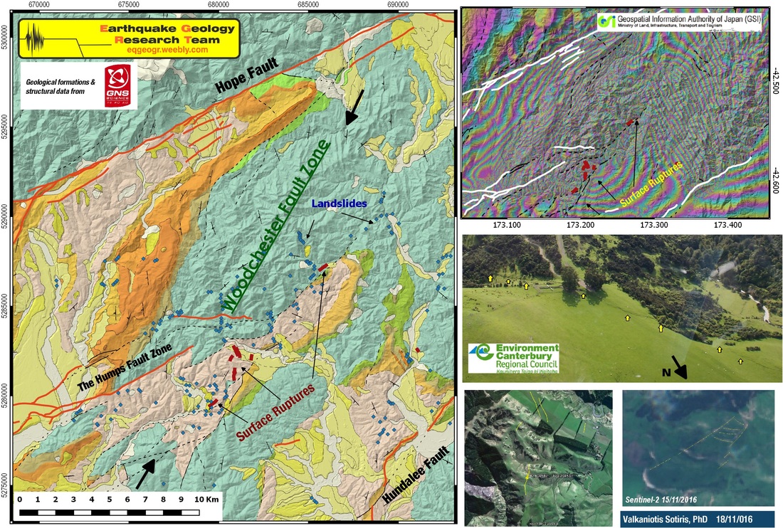
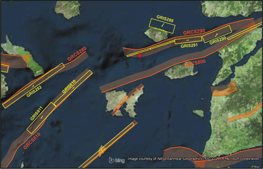
A first update on information and observation coming from New Zealand M7.8 earthquake. Primary and secondary surface ruptures are reported and observed (from east to west) on London Hill Fault, Kekerengu Fault, Papatea Fault, Jordan Thrust, Uwerau Fault, Hundalee Fault and the Humps Fault Zone. Possible surface slip too on Fidget Fault, part of Hope Fault (between Lyford & Stag And Spey). Also, newly unidentified or unmapped fault zones emerge, such as a western extension of The Humps Fault Zone below Emu Plain, the Woodchester Fault Zone (along this fault zone we observe an astonishing amount of ruptures and landslides) linking possibly Hope F. with The Humps FZ, and another SW-NE fault zone north of Hundalee.The presence of a possible offshore thrust zone near Kaikoura can be implied from InSAR first analysis announced.
A first update on information and observation coming from New Zealand M7.8 earthquake. Primary and secondary surface ruptures are reported and observed (from east to west) on London Hill Fault, Kekerengu Fault, Papatea Fault, Jordan Thrust, Uwerau Fault, Hundalee Fault and the Humps Fault Zone. Possible surface slip too on Fidget Fault, part of Hope Fault (between Lyford & Stag And Spey). Also, newly unidentified or unmapped fault zones emerge, such as a western extension of The Humps Fault Zone below Emu Plain, the Woodchester Fault Zone (along this fault zone we observe an astonishing amount of ruptures and landslides) linking possibly Hope F. with The Humps FZ, and another SW-NE fault zone north of Hundalee.The presence of a possible offshore thrust zone near Kaikoura can be implied from InSAR first analysis announced.
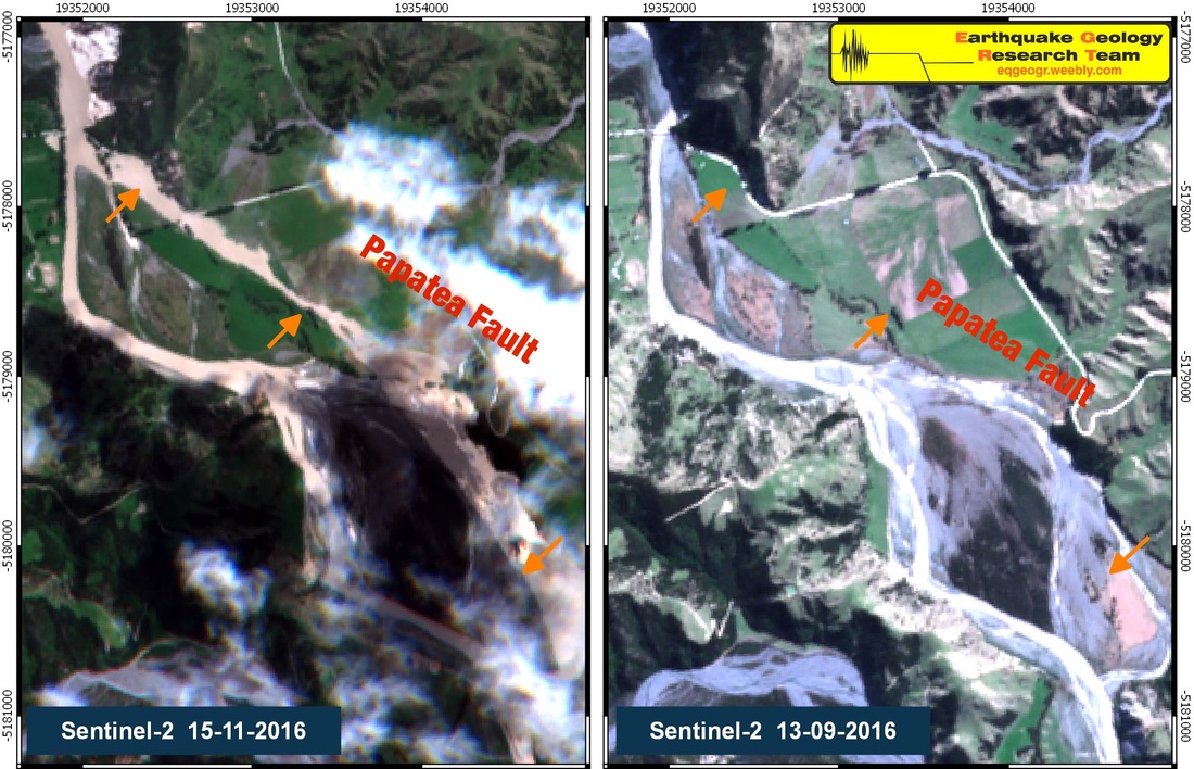
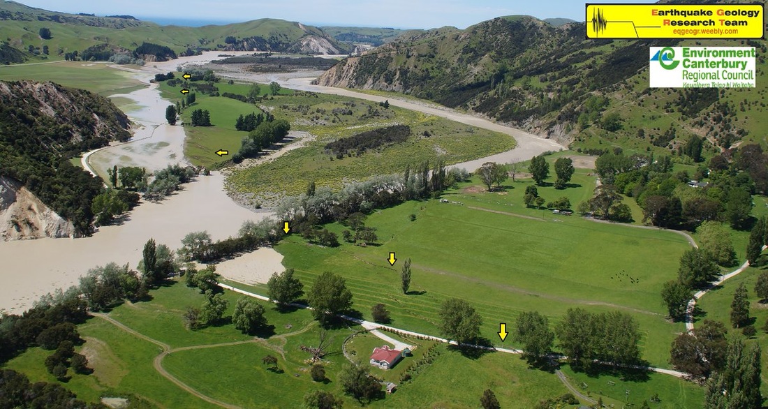
Papatea fault scarp crossing Clarence River
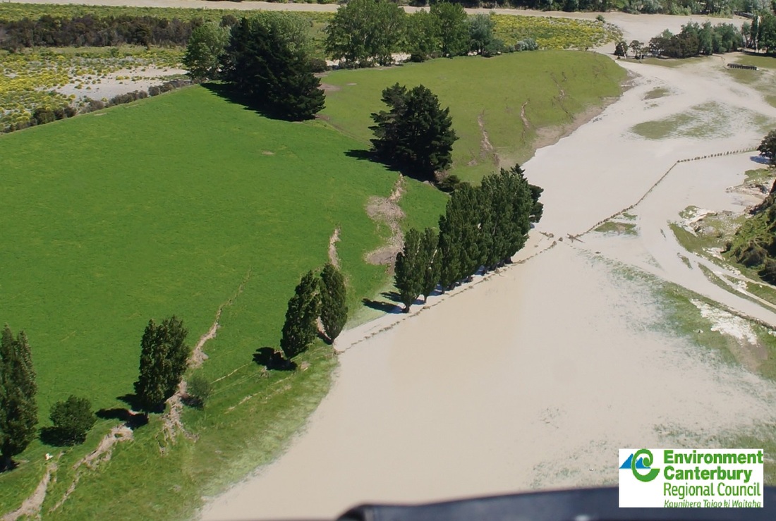
Papatea fault scarp diverting part of Clarence River flow. Thrust and en-echelon ruptures.
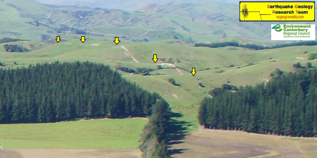
Fault scarp near Woodchester
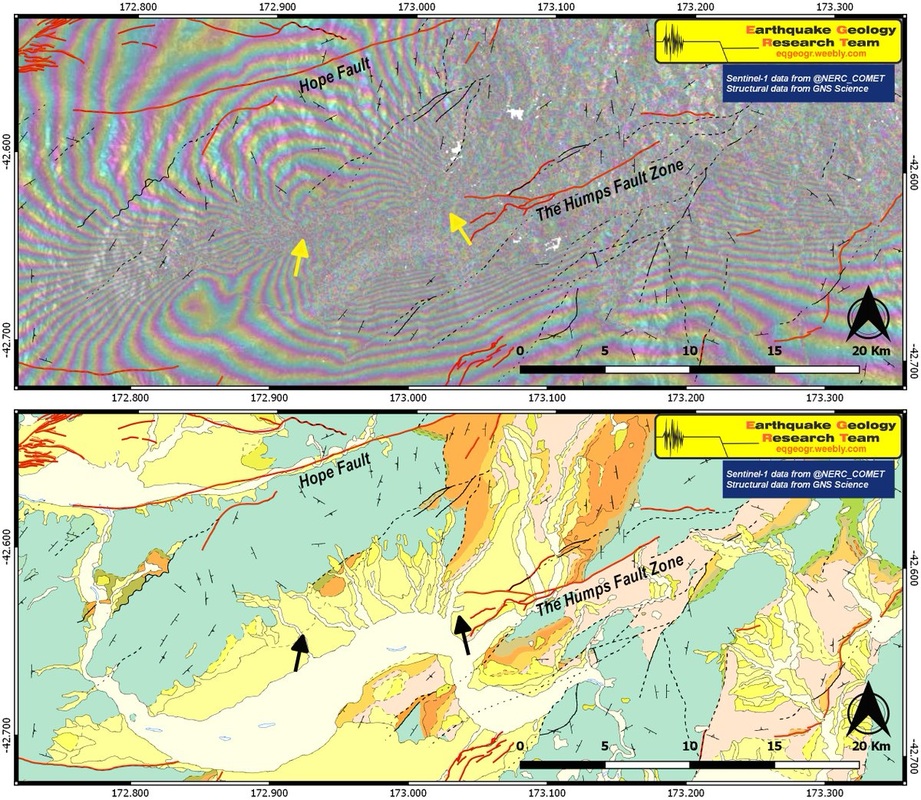
Unmapped fault beneath the Emu Plain, western extension of The Humps Fault Zone, near the M7.8 epicenter
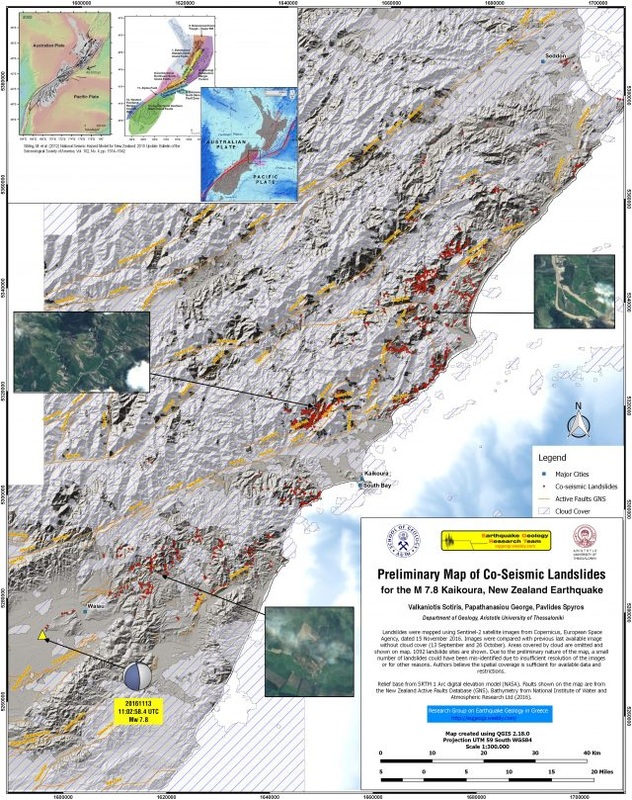
Check also the Preliminary Co-Seismic Landslide Map for the M7.8 Kaikoura Earthquake
https://zenodo.org/record/167130
Many thanks to those excellent sources of data and information about the Kaikoura earthquake:
InSAR
Centre for Observation and Modelling of Earthquakes, Volcanoes and Tectonics http://comet.nerc.ac.uk/
Geospatial Information Authority of Japan (GSI) http://www.gsi.go.jp/cais/topic161117-index-e.html
ALOS-2 PALSAR-2 Observation Results on New Zealand http://www.eorc.jaxa.jp/ALOS-2/en/img_up/dis_pal2_nzl-eq_20161115.htm
Other
GNS Active Fault Database https://data.gns.cri.nz/af/
Geological Data from GNS Geoserver http://maps.gns.cri.nz/geology/web/
Environment Canterbury Earthquake Response Aerial Photos canterburymaps.govt.nz
Sentinel-2 images from Copernicus http://scihub.copernicus.eu/


 RSS Feed
