Earthquake Geology in Greece
  • Home
  • Who we are
    • Spyros Pavlides >
      • Books
      • Papers
      • Conference Proceedings
      • Editor
      • Abstracts
      • Other
    • Alexandros Chatzipetros >
      • Papers
      • Conference Proceedings
      • Editor
      • Abstracts
    • Riccardo Caputo >
      • Papers
      • Proceedings / Extended abstracts
      • Editor
      • Abstracts
    • George Papathanassiou >
      • Papers
      • Conference Proceedings
    • Sotiris Valkaniotis >
      • Publications
    • Sotiris Sboras >
      • Publications
    • Anastasia Michailidou >
      • Publications
    • Stratos Delogkos >
      • Publications
    • Anna Zervopoulou >
      • Publications
  • What we do
    • Structural Geology
    • Active Tectonics
    • Paleoseismology
    • Fault Analysis
    • Liquefaction
    • Seismic Hazard Assessment
    • Seismogenic sources in Greece
    • Earth Science Teaching
  • Our projects
  • Database of active faults
  • Blog
  • Contact

Palaeoseismological trench of San Carlo - Sant'Agostino (Emilia Romagna, Italy)

10/7/2012

Comments

 
Picture


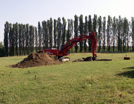
Research team: Riccardo Caputo (coordinator), Marco Stefani, Adriano Zanferrari, Eliana Poli, Luca Minarelli, George Papathanassiou, Kyriaki Iordanidou and Sotiris Sboras .

On May 2012, two moderate-to-strong earthquakes stroke the SEern region of Emilia Romagna among the towns of Bologna, Modena, Ferrara and Mantova. The first shock which occurred on May 20 was the strongest one and was accompanied by extensive liquefaction phenomena. The causative fault is a blind, reverse, S-dipping structure. The second strongest event occurred on May 29, but it is not clear if it produced newer liquefaction phenomena.

Extensive liquefaction phenomena and ground ruptures were documented in the area around Sant’Agostino, San Carlo and Mirabello, which represents an old river channel with its corresponding levee (see previously published post 1 and post 2). Near to the cemetery of Sant’Agostino – San Carlo, a NE-SW-trending ground rupture was observed, a location that was suitable for palaeoseismic and palaeoliquefaction investigations.

A 55 m-long and 5-6 m-deep palaeoseismological trench is excavated in a NW-SE direction. The trench cuts through the embankment deposits of a palaeochannel which are disturbed by secondary fractures filled in with liquefied sandy material. The fractures show a normal movement caused by the gravitational collapse of the levee.
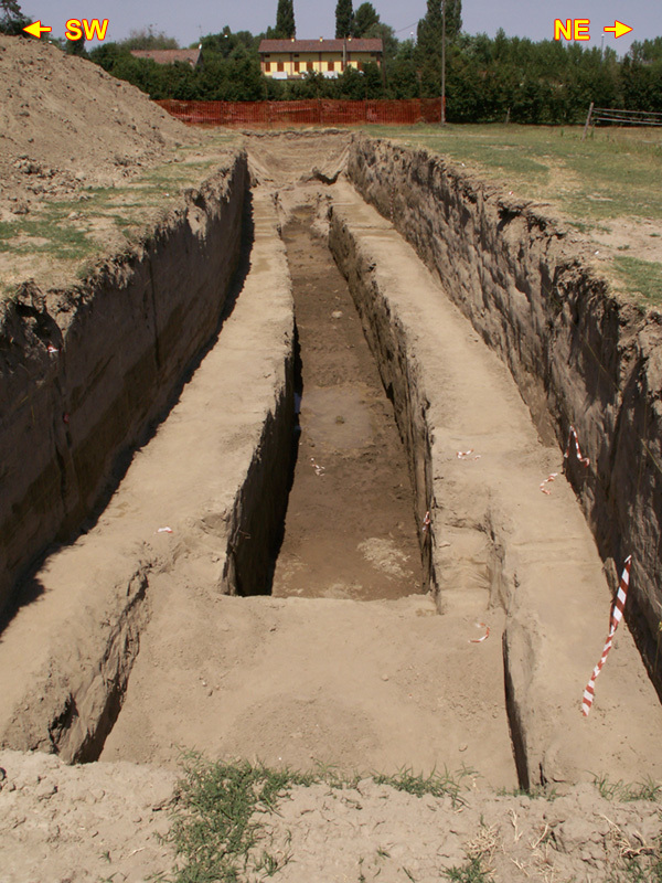
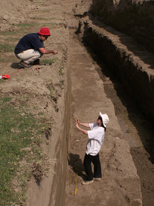


Picture
Picture
Comments

    EQ.GEO.GR blog

    News, facts and discussions related to earthquake geology research.

    Archives

    July 2017
    June 2017
    November 2016
    September 2016
    May 2014
    March 2014
    February 2014
    September 2013
    May 2013
    November 2012
    October 2012
    July 2012
    June 2012
    May 2012
    April 2012
    February 2012
    October 2011

    Categories

    All
    Active Faults
    Aegean
    Gre.Da.S.S.
    Greece
    Lesvos
    Paleoseismology
    Seismic Hazard

    RSS Feed

Powered by Create your own unique website with customizable templates.